
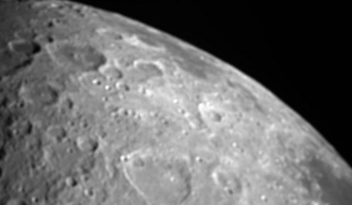
NASA’s CAPSTONE mission — a microwave oven-sized CubeSat — captured its first images of the Moon, showing the lunar surface near the Moon’s North Pole.
The Cislunar Autonomous Positioning System Technology Operations and Navigation Experiment (CAPSTONE) captured the image as it made a close approach to the Moon on May 3.
It also successfully tested a navigation technology akin to Earth’s GPS for the first time, advancing a capability that could help future space missions more efficiently navigate at the Moon.
The spacecraft weighing just 25 kgs lifted off to the Moon on June 28, last year, aboard a Rocket Lab Electron rocket. It is the first spacecraft to test a unique, elliptical lunar orbit.
It flies in cislunar space – the orbital space near and around the Moon. The mission will demonstrate an innovative spacecraft-to-spacecraft navigation solution at the Moon from a near rectilinear halo orbit slated for Artemis’ Gateway.
The test of the mission’s CAPS technology involved two spacecraft: CAPSTONE and NASA’s Lunar Reconnaissance Orbiter (LRO).
During the May 9 experiment, CAPSTONE sent a signal to LRO designed to measure the distance and relative velocity between the two spacecraft.
LRO then returned the signal to CAPSTONE, where it was converted into a measurement. The test proved the ability to collect measurements that will be utilised by CAPS software to determine the positioning of both spacecraft. This capability could provide autonomous onboard navigation information for future lunar missions.
In addition to the successful CAPS test, CAPSTONE achieved another mission objective to fly the near-rectilinear halo orbit for at least six months.
This marks the end of the spacecraft’s primary mission, and CAPSTONE will continue flying in orbit and testing onboard technologies for up to a year during its enhanced mission phase.


Add Comment